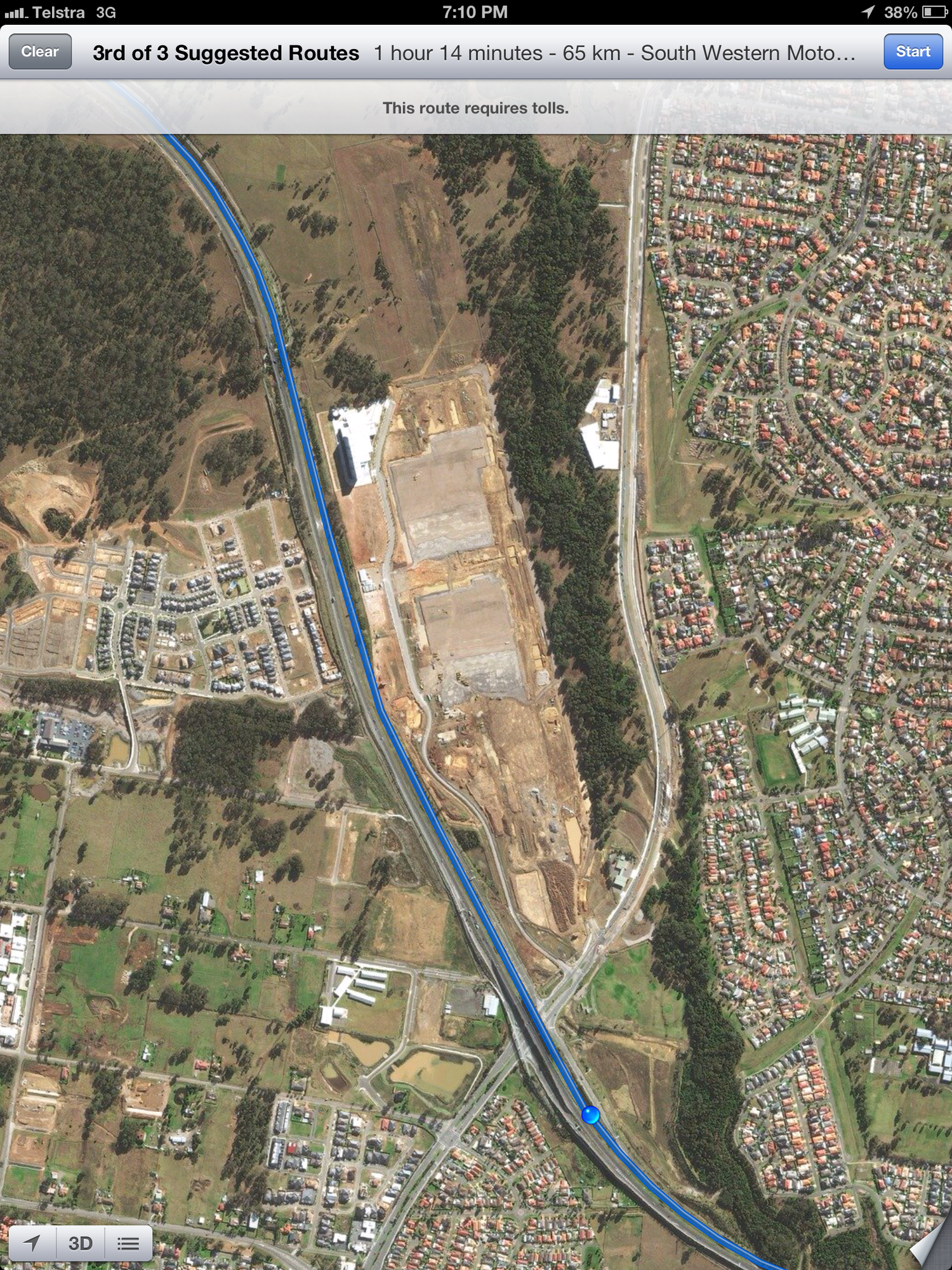
While on a trip to the Warragamba Dam today, Anthony recognised a location that we drove past on the M7 (Westlink) highway as the Hoxton Park Airport, a small regional airport. However, instead of the usual airport terminal buildings, it looked like a complex of warehouses and offices now. Curious as to what's happened, I looked it up on Apple Maps on my iPad.
The satellite imagery seemed a bit outdated, showing what looked like a construction site, with no buildings. On the northern end of the brown dirt, you could just about make out the remnants of what were the runways.
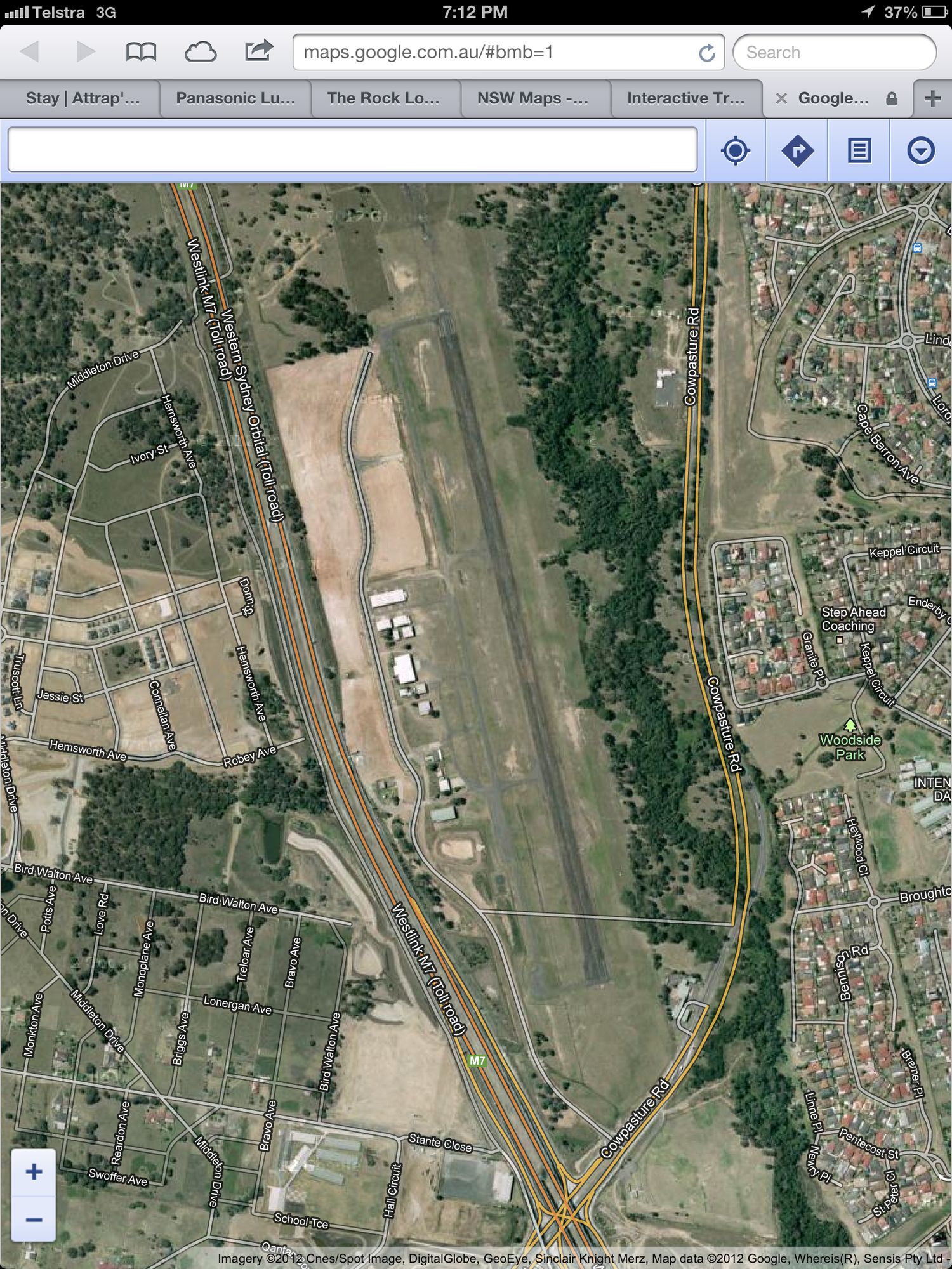
Since everybody's having a big whinge about how crap iOS6's maps are, I thought I'd compare it with the superior Google Maps (using Safari). It showed very clearly two landing strips and a few small buildings. Nothing like what is actually there today.
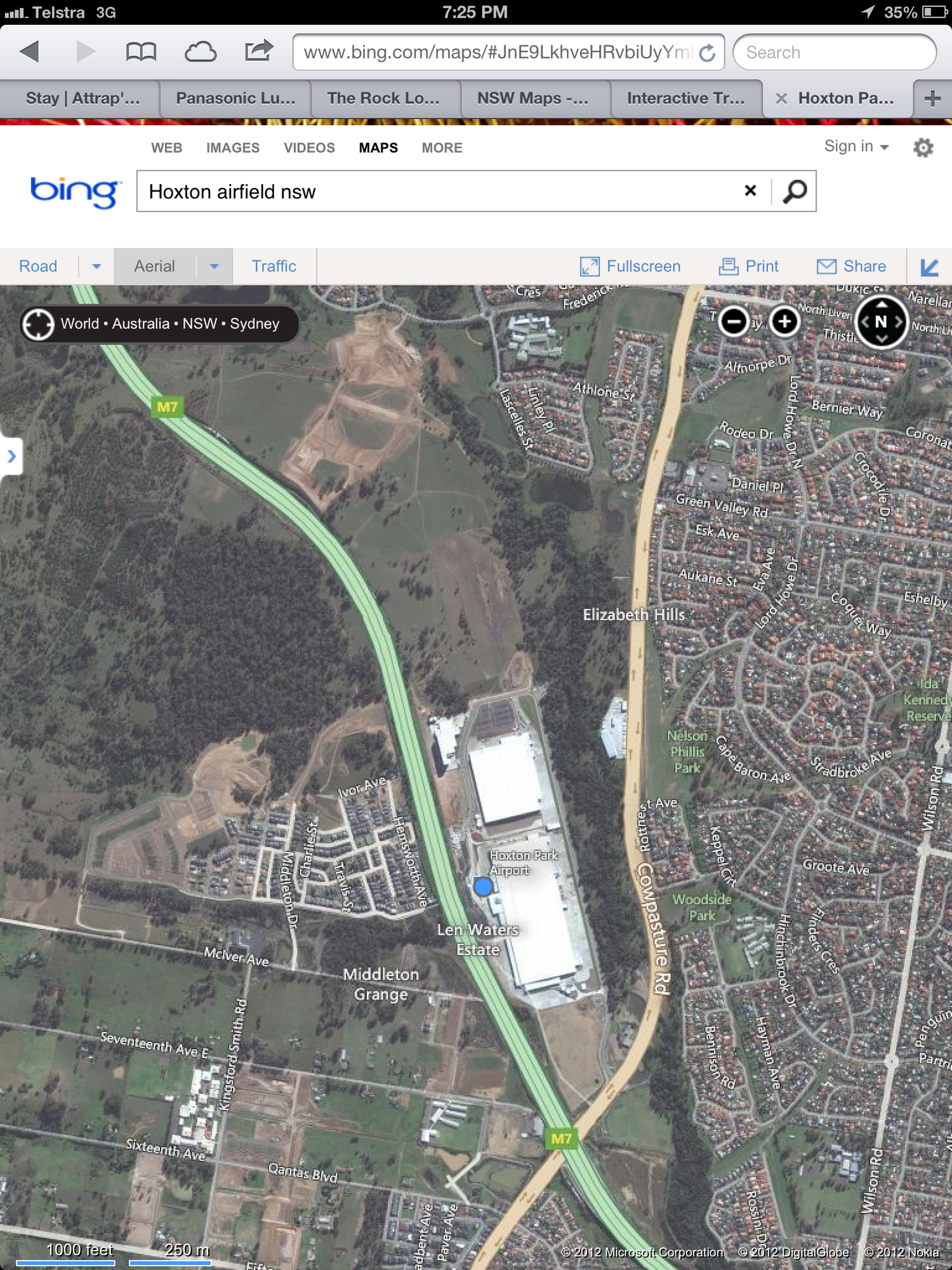
I've never used Bing Maps at all, but I though I'd give the benefit of the doubt and give it a go. I was not hopeful that Bing would be any better than Apple or Google in their mapping solution. To my surprise, Bing Maps' satellite view showed the new buildings, clear as day.
Just comparing the area around it, there also seemed to be a few other developments in the area that Apple and Bing maps have, but still look like farmland on Google Maps. To Google's credit though, they still had the correct roads and road names on the maps overlay, even though it doesn't match up with anything on the satellite image.
This quick test turned out to be quite an eye-opener for me, that Google Maps actually had the most out-of-date satellite imagery, and Bing was the most accurate. Maybe it's time to reconsider other options.


